SpecialSetOfSieves

joined 1 year ago
[–] SpecialSetOfSieves@lemmy.world 1 points 1 day ago (1 children)

Ah yes, I saw that in pre-print. For a moment I thought this was the paper about the clay-rich/high-aluminum white rocks down in the crater, but yeah, this is some fundamental work by Kathir et al., with very nice figures to boot. This quote has me laughing right now:

The Noachian basement unit of the Jezero watershed unit is enriched in Fe/Mg-smectites, but we have found no float rocks with these compositions. This suggests that Fe/Mg-smectite-rich outcrops are friable, poorly lithified, and not well-cemented, and thus less resistant to erosion.

LOL You don't say... now where have I seen rocks like that recently? πŸ˜†

[–] SpecialSetOfSieves@lemmy.world 2 points 1 day ago* (last edited 1 day ago) (2 children)

For reference, the rover position on sol 1549 is just a few metres west of abrasion patch #38:

I've marked with a red "x" the four locations on the rim where we've failed to abrade or sample so far. (Sorry about the map quality, it's a work in progress...)

[–] SpecialSetOfSieves@lemmy.world 2 points 1 day ago (1 children)

Hmmm. Very nearly back to the site of abrasion patch #38, I see. I wondered if they would drive the rover to the nearest geologic contact, after seeing all the difficulty we've been having in the clay-bearing zone. Patch 38 fractured badly, too, but at least we were actually able to make the abrasion.

This mission really has seen a night and day difference since we summited the rim toward the end of 2024. I was taken aback last (Earth) year at seeing how quickly the science team was driving Percy up the inner rim, but now? The traverse map on the outer rim looks closer to the path a human geologist would take when learning a field site - learning the lay of the land, then back and forth, stopping for detailed work. And it's summer here at the field site, too. After all that this rover has seen and done in 4 Earth years, I really wouldn't have imagined how new and invigorating this crater rim campaign would be. So much to see, in such a small area...

[–] SpecialSetOfSieves@lemmy.world 2 points 2 days ago (1 children)

Yep. I am smrt. (Thanks, Paul!)


Three sols after the first (messy, unsuccessful) attempt to abrade another rock in this clay-bearing region of the crater rim, Percy has made a second attempt, less than a metre away.

This target seems not to have fractured and broken as quickly and easily as the previous stuff, but this latest attempt ended after only 13 minutes - shorter than the usual 15-25 minutes required at other abrasion sites, but longer than the previous one, which ended after only 10 minutes. I'm wondering if the rover was programmed to use less force with this abrasion; if so, the results so far are not encouraging.

Mars is hard. Even when it's not.

[–] SpecialSetOfSieves@lemmy.world 2 points 4 days ago (1 children)

Sol 1547 - They're taking another poke at the outcrop, just centimetres away from the last target:

 
[–] SpecialSetOfSieves@lemmy.world 2 points 6 days ago (1 children)

I'll cheat, rather than taking the bet. 😁

The SHERLOC team usually takes two images of a target before abrading (the close-up at a ~5 cm standoff, the wide-angle at ~25 cm), which is what this shot (close-up) and this shot (wide-angle), taken on Sol 1545, appear to be.

On casual inspection, I don't see much difference between this new possible target and the one that didn't work out on 1544 (close-up here, wide-angle here), but... I'd really like to abrade this stuff, too. This clay-bearing unit we seem to be driving on makes a nice contrast with the failed abrasion site higher up on the rim, where the rock was actually too hard to abrade, and sure seems different from the almost rhythmic material down on the flat...

Still can't believe we've been set free to rove on Nili Planum.

[–] SpecialSetOfSieves@lemmy.world 2 points 1 week ago (1 children)

Aside from those already listed in the other post, there's only one other patch for which I don't have a given name (#34, Sol 1395), so that's a total of four.

The drilling/abrasion tools on Curiosity and the MER twins have given us a good idea of the rock strength encountered by those rovers, but I haven't seen much research on the subject for Percy as yet. It's a little frustrating - that's a stat I'd like to include when writing up the different patches, it really would help tell a story. I know the mission has enough "drill parameter" data to make an interesting tale...

[–] SpecialSetOfSieves@lemmy.world 2 points 1 week ago (1 children)

From the blog:

Perseverance performed an initial toe-dip into this clay-bearing unit back in April, creating the Strong Island abrasion patch, before returning back upslope to Witch Hazel Hill to sample some spherule-bearing rocks. Since then, Perseverance has started exploring this clay-bearing unit more extensively, creating the Laknes abrasion on Sol 1526.

Allow me to add, for your viewing pleasure:

36 - Slants River
37 - Name not given - but my nickname for it is "Subtle Scales"
38 - Strong Island
39 - Hare Bay
40 - Name not given - let's call this one "Frisky Freckles"
41 - Name not given - I'll call it "Too-Creamy Coffee"
42 - Laknes


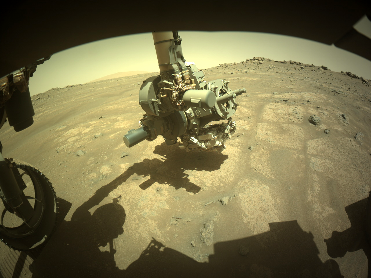
No image of a freshly abraded rock has been uploaded to the JPL server as yet, and we've only received 10 frames of the abrasion operation so far (spanning about 10 minutes of work), so I'm not sure what to think. Did the rover sense a problem and end the abrasion early? As the animation shows, the arm and the abrasion bit actually shifted a bit during the operation, which is not unprecedented, but it may be that Percy stopped as a precaution.

All the other recent abrasions took longer than 10 minutes (between 15-25), so I can imagine that the process wouldn't quite be done. ~~An earlier post by Paul Hammond shows that Percy is currently very close to the site of abrasion patch #40, which was evidently easier to work with than this weak, fractured stuff, though it was only metres away from here.~~

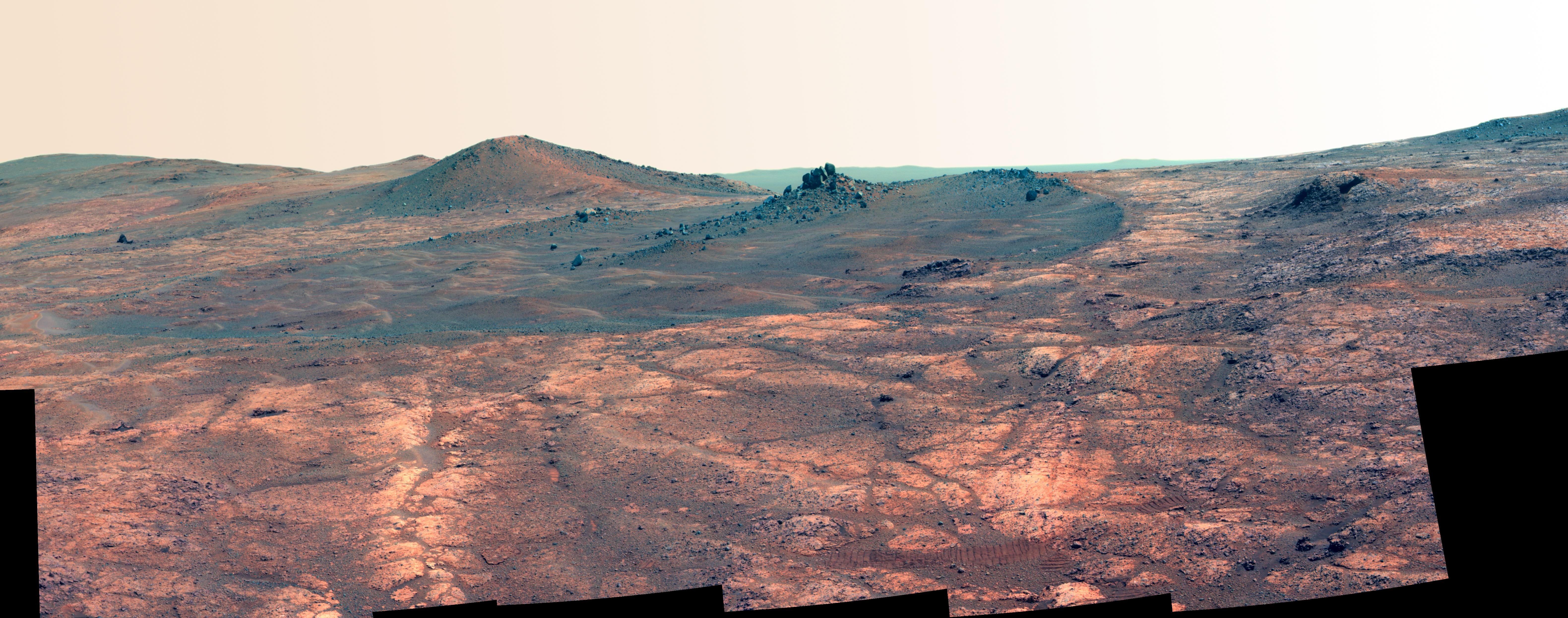
The rocks on this great big crater rim are yielding amazing science, but they are damned finicky to work with.

EDIT: As of this sol (1544), Percy is about ~100 m east of the site of abrasion patch #40, and ~100 m west of abrasion patch #38. My apologies for the error!

First of all, I have to say that this is a very thoughtful and useful reply. I've actually re-read it several times now, perhaps because it's given me different ideas each time I've read through.

That Fujifilm link is one of the best justifications I have ever seen to keep an unreasonable number of browser tabs open, hahaha. Aside from realizing that I hate the "Provia" film simulation, there is a lot of meat there... in fact, everything you're touching upon tells me that there is more room for experimentation/fooling around/creativity with our planetary imagery than even I had thought.

In planetary science, "experimenting with color" (OK, "multispectral data") is a learned skill that is actually taught to undergrads nowadays, but it's a lot more mathematical than what Fuji is talking about, and I've never heard anyone (instructors or students) talk about perception and such in the way you're doing here. OK, so I may be extremely bad at art, but nobody can stop me from playing with landscape photos from Mars, and I think I'm going to start. That being said, I think what you're saying should motivate actual visual artists to look at and reproduce their individual visions of this stuff a lot, lot more...


Two images of the Nili Plateau landscape to the west of the rover: one taken at about 1:30 PM local time, the other at about 7 PM, in early summer.

The evening shadows really give the landscape a definition and intrigue which the hazy afternoon sun barely hints at, with even small pebbles standing out, and those sandy mega-ripples down below much more easily identified in the distance.

OTOH, I find that the rover tracks (on the right) become harder to see in the evening, so your hiking skills and common sense are key on late-day excursions. You definitely don't want to be lost in this landscape after dark as temperatures quickly head for -100 ΒΊC...

[–] SpecialSetOfSieves@lemmy.world 3 points 1 week ago* (last edited 1 week ago)

I'm as far from being an artist as you can get, but I like what you and supersquirrel are aiming at. As you know, I've been thinking about data visualization and presentation for these missions a fair bit recently. Personally, I find natural color images like this one from the curvilinear unit plenty spectacular and readable as is, but in general, a lot more work needs to be done to convey these missions to people.

If I've learned anything from supersquirrel's point, it's that we need to show multiple perspectives on the landscapes these rovers see. The missions have a natural tendency to do most of their imaging during the middle of the day, but that hazy dusty mid-day illumination is nothing like the sharp lighting that morning and evening shadows bring to the landscape. At the same time, I'm always worried about data/visual overload in these situations...

[–] SpecialSetOfSieves@lemmy.world 3 points 1 week ago (2 children)

Interesting.

I've been looking at rover images for so long now (20+ years without any significant interruption) that I don't even see "beige planet" anymore. It's been long enough that I find non-geologist perspectives like yours kinda refreshing. I hope you don't mind a couple of questions:

  • Do images like the one below help with the appreciation part? It's a montage from Perseverance of all the abrasion holes it's made so far. No color processing whatsoever, no artistry, just the raw, sunlit, close-up images.

I'm showing this just so you can see the natural range of colors that get exposed once the ubiquitous red dust gets swept away. Still a lot of orangey-beige at first glance here, admittedly, but the tans, ruby reds and browns really pop in the full-res images.

  • Older missions used to use false color images as well as natural color images - often to spectacular effect (see this false color vs. natural color pair from Opportunity). Do you find the false color images more palatable?

Serious questions here. I'm always wondering how science people can convey this stuff better to the broader public. I like your idea about the artists, that's for sure.

[–] SpecialSetOfSieves@lemmy.world 2 points 1 week ago (1 children)

I miss those. These missions need a great deal of mapping to really be understood. Thanks for doing those, I hope to see them again!


Taken approximately 45 min after sunset on Sol 1528 (original NavCam frames here and here).

Bright white streak at far right - noctilucent cloud?


Original NavCam image from Sol 1519, taken just a few hours ago


For more details on this latest sample (which has not yet been sealed away), the mission has posted an informative blog as well, but Mars Guy brings the neat animations and the narrative, as always.


Some quick analysis:

  • Well, let's see... this one isn't fractured like half the patches we've made on this outer rim of Jezero (e.g. #39, #36), has a neat circular outline, and seems to have reached a decent depth. Seems like a clean abrasion to me. So that means it would be difficult to sample, right? πŸ˜†

  • The target rock seems to have been chosen in part because it forms small resistant "nubs" (that is, it forms little ridges; the stuff hasn't been eroded down to near-perfect smoothness, like some other outcrops that gave the sampling system a lot of trouble). The chisel marks on this patch - the lines radiating from the center - aren't very distinct like past ones (e.g. #30, which features some harder volcanic minerals), so it is probably average in terms of hardness.

  • Just look at all those dark spots, dramatically sprinkled through the dark tan body of this rock! Patch #39 had dark grains too, but they were much smaller, much more rounded; the science team thinks those are spherules embedded in the rock up there. Not so down here. If you zoom in, you can see that the dark material seems to be made of clumps of different, smaller grains, rather than just being one kind of mineral. It looks like we've got a grab bag of different things going on here, which is always exciting! In fact, this one doesn't really resemble any of the prior 39 patches. And that only makes this one more interesting, because...

  • Percy is near the bottom of the outer rim, just above the local floor of the Nili Plateau, which features some of the oldest known rocks on Mars - and could be dramatically different from what Percy or any other rover has explored so far. Yes, we know Mars was wet, we know there was a much different climate billions of years ago - but when did that begin? We just might be in the right place to begin finding out...


For those unaware, Perseverance and Curiosity are both armed, like the good patriotic American rovers they are - equipped with lasers which have a definite scientific function, but which also (let's be honest) serve to dissuade any Martian critters they come across from getting too close...

Let's hope Sheriff Percy doesn't need to use it.

Original image with caption (MastCam, sol 1495)


Some quick analysis:

  • Not the cleanest, neatest abrasion, as we see from the broken outline from 10 to 12 o'clock, but at least this stuff didn't fracture badly, like the one further downhill that we made just last week (#38), or two other ones we made on this side of the crater rim (#36 and #33). Surprisingly, we successfully sampled the latter two, so #39 may be a candidate for drilling as well.

  • The target rock seems reasonably hard (note that the chisel marks - those lines radiating outward from the centre - are well-preserved and easily visible), which is not always the case: see #32, which crumbled into dust every time we tried to sample the stuff.

  • Those small, dark grains (toward the edge, between 1 and 2 o'clock) - pretty interesting; nothing quite like them has been found in any other target we've abraded on the rim so far. As a (very) general rule, darker minerals are often igneous (volcanic). Not saying that's the case here, but they sure stand out in this buff/tan-coloured material.

  • This crater rim/hillside really is an amazing place. The other patches I've linked to were taken just hundreds of metres away. We've made about 8 of these abrasion patches now over this one stretch of crater rim (roughly half a kilometre long), and we've sampled multiple times, more than in any other section. The geologic diversity packed tightly together in adjacent layers - featuring stuff like crater impact debris beside solid but heavily soaked minerals - is seriously wild!

view more: next β€Ί